How to Use the Seoul Subway Map: Tickets, Transfers and Exits
In this guide
- First, understand what the map is showing
- Use station numbers as a second language
- Check your direction before entering
- How to transfer without leaving the station
- Entering the subway: transit card or single-use ticket
- How to choose the correct exit
- A complete first ride, step by step
- Mistakes that cost visitors time
- Use a route app, then check the station signs
- Download the official English map
- The simplest rule to remember
- Sources and fact check
- About the author
Last checked: 19 September 2026, using official information from the Seoul Metropolitan Government and the Korea Tourism Organization.
Seoul’s subway map can look overwhelming at first. It covers Seoul as well as parts of Incheon and Gyeonggi Province, and the diagram contains far more than the nine numbered lines most visitors expect.
You do not need to understand the entire network. For any journey, you only need to answer four questions:
- What is the name and number of your starting station?
- Which line do you need first?
- Which station name appears in the direction you are traveling?
- Where do you transfer or leave the station?
Use those four details for each journey, and the map becomes much easier to read. A downloadable 2025 English map is available near the end of this guide, so you can keep a copy on your phone for offline reference.
First, understand what the map is showing
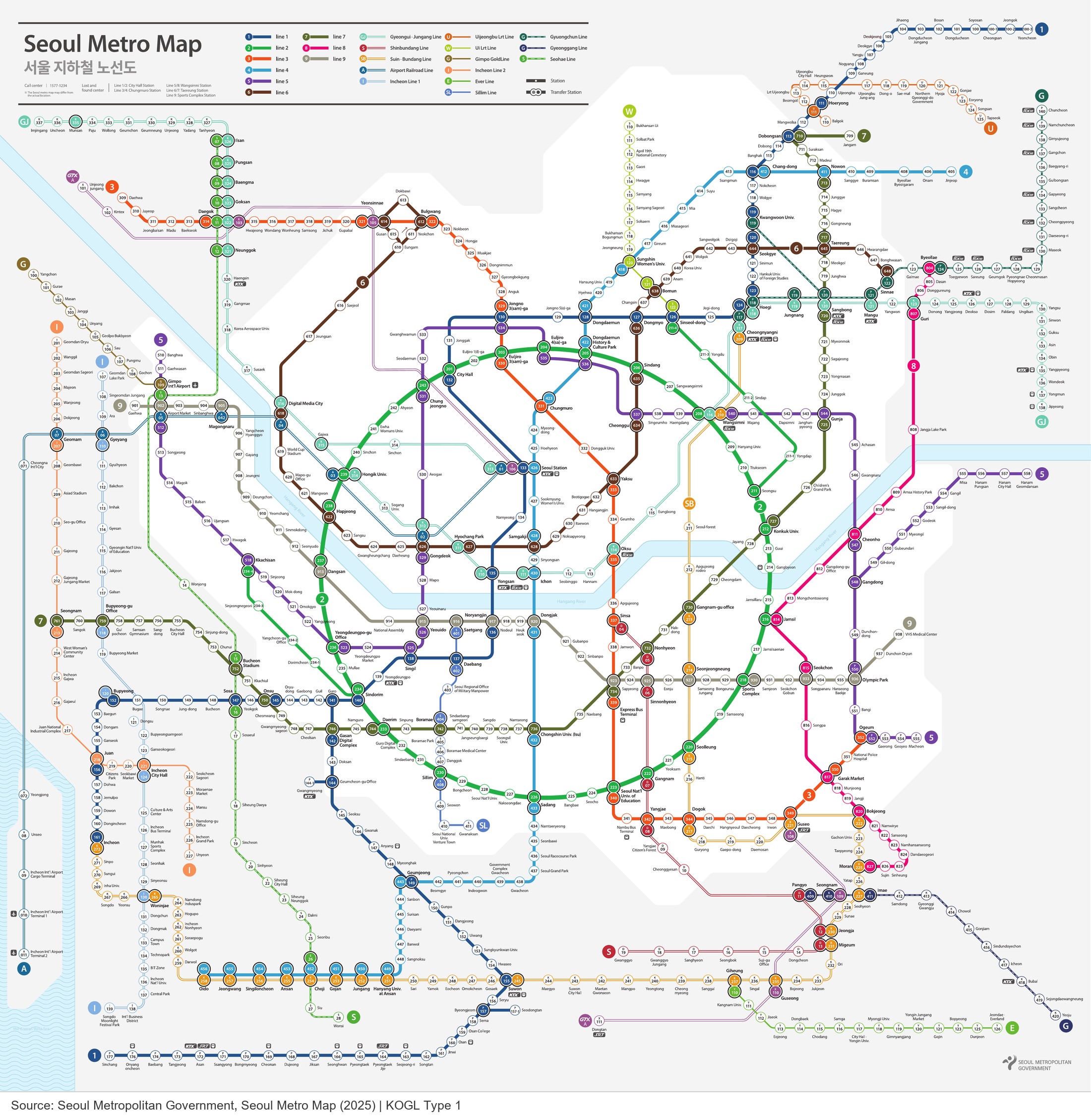
The Seoul subway map is a schematic diagram. It simplifies the shape of the city so that lines and transfer stations are easier to follow. The distance between two stations on the map does not represent the actual distance on the ground.
Each line has a name or number and its own color. Lines 1 to 9 serve many of the places visitors use most often, but the same map also shows the Airport Railroad, the Shinbundang Line, the Gyeongui–Jungang Line and other regional services.
A normal station appears on one line. A transfer station is connected to two or more colored lines. On Seoul’s redesigned map, transfer stations use a traffic-light-style marker that shows the colors of the available lines.

The pale blue band crossing the map is the Hangang River. It is a useful geographic reference: Myeongdong, Jongno and Hongdae are north of the river, while Gangnam, Jamsil and much of southern Seoul are below it.
Use station numbers as a second language
English station names are displayed throughout the system, but station numbers are often faster to recognize.
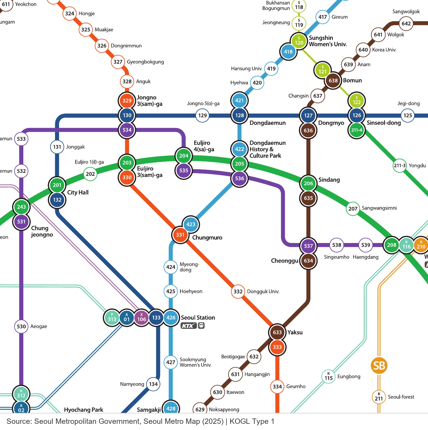
On the numbered lines, the first digit normally identifies the line and the remaining digits identify the station. Anguk, for example, is Station 328 on Line 3. Myeongdong is Station 424 on Line 4. Hongik University is Station 239 on Line 2, although it also connects to other rail lines with their own identifiers.
Station numbers are especially helpful when two English names look similar or when a Korean announcement is difficult to catch. Save both the name and number of your destination before leaving your hotel.
Check your direction before entering
Knowing the line is not enough. Every platform serves a direction, and Seoul’s signs often describe that direction using upcoming stations or a terminal station rather than “eastbound” or “westbound.”
Before passing through the gate, find your destination on the line and look at the next station in that direction. Then follow the platform sign that lists that next station.
For example, imagine that you are traveling from Anguk on Line 3 to Myeongdong on Line 4:
- Start at Anguk, Station 328.
- Take Line 3 in the direction where Chungmuro appears ahead.
- Get off at Chungmuro, a transfer station for Lines 3 and 4.
- Follow the signs for Line 4.
- Check that Myeongdong is the next station in your chosen direction.
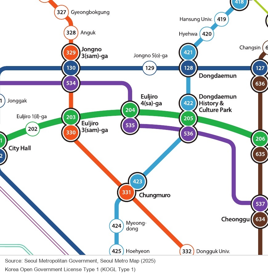
This “next-station check” is more reliable than trying to memorize a terminal station you have never heard of.
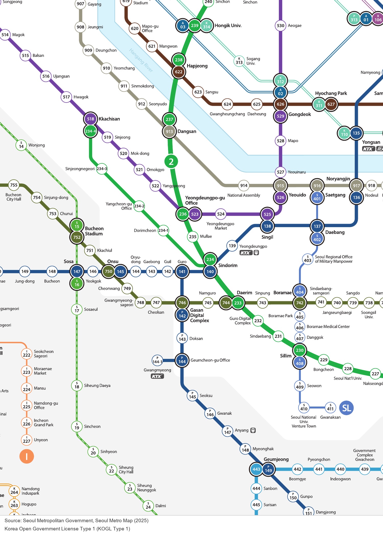
Some metropolitan lines split into branches. Line 1 is a common example. When a route has branches, check the train’s destination display as well as the platform. Two trains can use the same platform and later travel to different destinations.
How to transfer without leaving the station
Transfer stations can involve a short walk or a long one. Follow the colored line marker and the word Transfer rather than the yellow Way Out signs.
If you pass through an exit gate by mistake, you may end the journey and create a new fare when you enter again. Stay inside the paid area and follow the transfer corridor. Escalators, stairs and moving walkways may all be part of the route.
Before following a transfer corridor, check three things:
- the number or name of the new line;
- the color of that line;
- the next station in your required direction.
Do not plan an extremely tight connection just because two lines touch on the map. The map shows that a transfer is possible, but it does not show how far you will walk inside the station.
Entering the subway: transit card or single-use ticket
For most visitors, a rechargeable Tmoney card is the simplest option. It is sold at participating convenience stores and subway station service points. Some reload machines still require Korean won cash, so keep a small amount of cash available and check the payment symbols before loading the card.
Tap the card on the reader at the entrance gate and tap again when you leave at your destination. The exit tap calculates the distance-based fare and preserves eligible transfer benefits if you continue by bus.
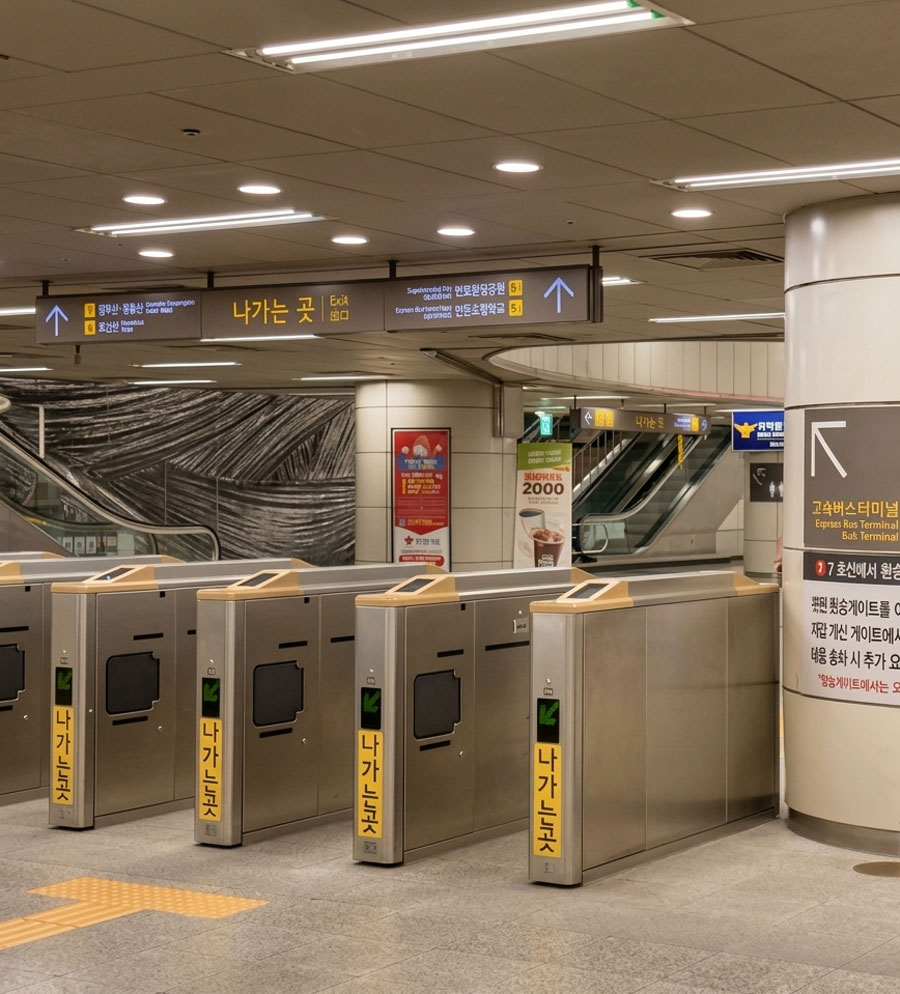
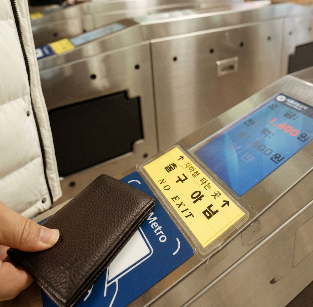
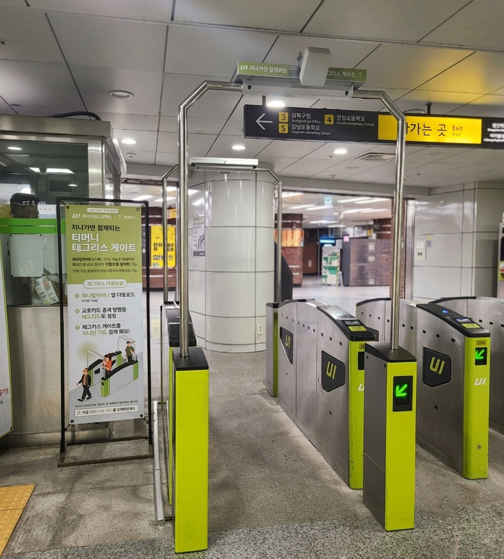
You may also see bright green Tmoney Tagless gates at some stations. These are designed for passengers who have already set up the supported mobile service. If you have not set it up, use a standard gate and tap your physical card as usual.
If you do not have a transit card, use a multilingual ticket machine to buy a single-journey transit card. It works for the selected subway journey but does not provide the same bus-transfer benefits as a rechargeable transit card.
How to buy and return a single-journey transit card
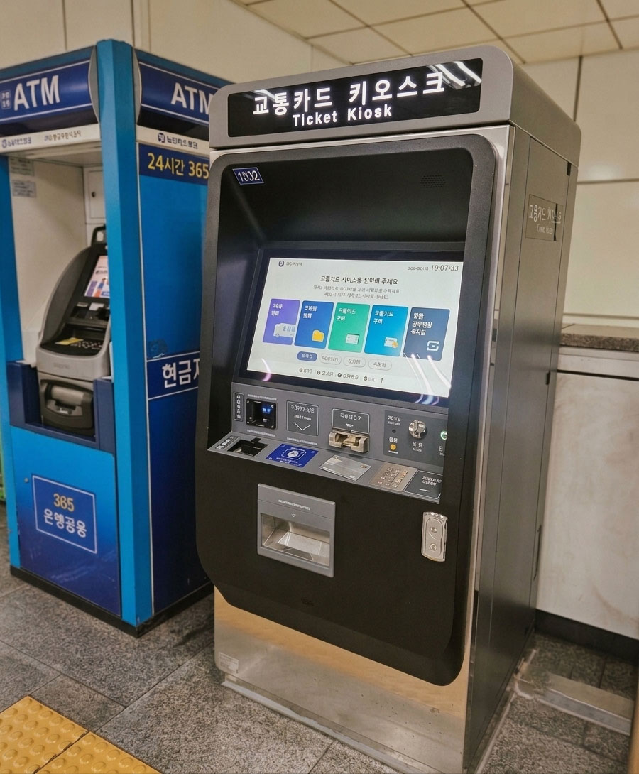
- Select your language, then choose Single-Journey Ticket on the screen.
- Search for and select your destination station. Choosing the destination allows the machine to calculate the distance-based fare.
- Select the number of tickets and pay the total shown on the screen. The total includes the fare and a refundable KRW 500 deposit.
- Collect the card from the illuminated tray near the bottom of the machine. Tap it on the gate reader to enter and tap it again when you leave at your destination.
- After passing through the exit gate, insert the card into a Deposit Refund Device. The machine returns the KRW 500 deposit.
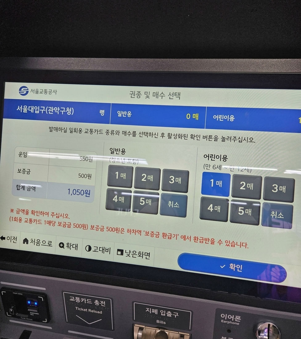
As of 17 March 2026, Seoul has 440 new vending machines at 273 stations on Lines 1–8 that accept internationally issued credit and debit cards and supported mobile payments. These machines can sell single-journey transit cards and selected Climate Card products. The city reports an average service fee of about 3.7% for international card transactions. Not every machine has this function, so check the payment logos before starting.
Fares and payment options change, so check the current official guidance on the day you travel rather than relying on a price quoted in an older article.
How to choose the correct exit
Reaching the correct station is only half the journey. Large stations can have more than ten exits, and the wrong one may put you across a major road or several blocks from your destination.
Before you board, save the exit number for the place you are visiting. Near the end of the journey, look for yellow Way Out signs and match the exit number. Station directories usually list nearby streets, buildings and attractions.
If an elevator is important, check the station layout rather than assuming every exit has one. The closest exit on a map may not be the easiest exit with a suitcase, stroller or limited mobility.
A complete first ride, step by step
Use this sequence until it becomes automatic:
- Search for the exact station, not only the neighborhood name.
- Note the station name, number and line color.
- Check whether the route requires a transfer.
- Save the destination exit number.
- At the station, follow signs for the correct line.
- Confirm the direction using the next station on the route.
- Tap your card and enter.
- On the platform, confirm the train destination if the line has branches.
- During a transfer, follow the new line’s color and number without following exit signs.
- At your destination, tap out and follow the saved exit number.
Mistakes that cost visitors time
Searching for an attraction instead of its station
A palace, market or neighborhood may sit between several stations. Find the exact station and exit recommended for the entrance you plan to use.
Choosing the right line in the wrong direction
Always check the next station before boarding. If the next station shown on the platform is on the opposite side of your route, cross to the other platform by following the signs. Do not assume every station allows a simple platform change without stairs or another corridor.
Treating the subway map as a street map
The map is designed for route planning, not walking navigation. Use a street map after choosing your exit.
Ignoring branches and train destinations
This matters most on services that continue far outside central Seoul. Check the destination display before boarding and compare it with your route app.
Following “Way Out” during a transfer
Yellow exit signs lead out of the paid area. Transfer signs lead to another line. Pause and check the wording before following the crowd.
Use a route app, then check the station signs
Seoul Metro’s website provides a multilingual network map and station information. Naver Map and KakaoMap are useful for door-to-door planning, but once you are underground, compare the route with the line number, destination and next-station signs on the platform.
Save or screenshot the route before entering the station. You will still have the line, transfer and exit details if roaming data or an app fails.
Train frequency, the last train and service changes vary by line, station and date. Check live information rather than relying on a fixed timetable quoted in an old blog post.
Download the official English map
| File information | Details |
|---|---|
| Language | English |
| Format | |
| File size | 3.9 MB |
| Map edition | 2025 |
| Publisher | Seoul Metropolitan Government |
| Licence | Korea Open Government License Type 1 |
The downloadable file is the official map supplied by the Seoul Metropolitan Government. Save it before your journey if you want an offline reference. The map may be shared, used commercially and adapted under the Korea Open Government License Type 1 as long as the source is credited.
The simplest rule to remember
Do not try to memorize Seoul’s entire subway system. For every leg of the journey, match station number, line color, direction and exit number. If all four match, you are almost certainly on the right route.
Sources and fact check
- Seoul Metropolitan Government: Subway information, map and fares
- Seoul Metropolitan Government: Public transportation guide
- Seoul Metropolitan Government: How the redesigned subway map works
- VISITKOREA: Subway usage guide
- VISITKOREA: 2026 transportation and payment guide
- Seoul Metropolitan Government: How to buy and return a single-journey transit card
- Seoul Metropolitan Government: International cards at new subway ticket machines
No affiliate links have been added. Fare figures were deliberately omitted from the main copy because they may change. Payment methods, service notices and last-train information should always be checked for the date of travel.